|
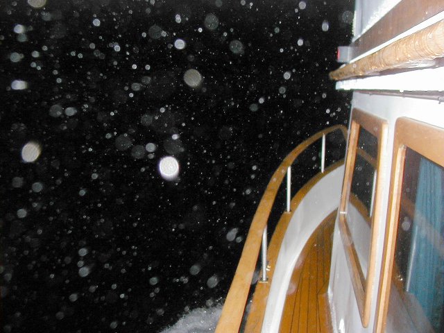
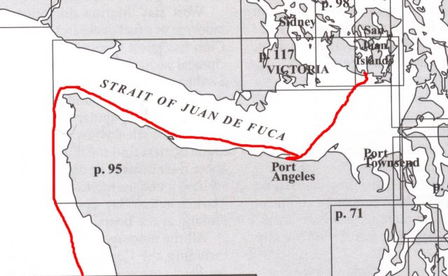
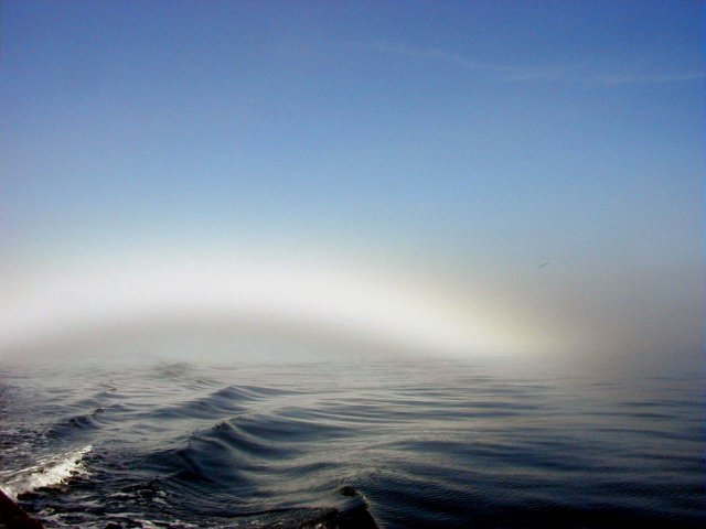
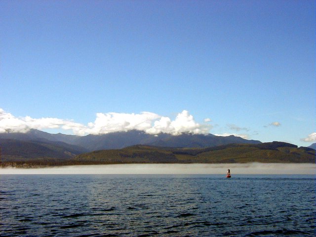
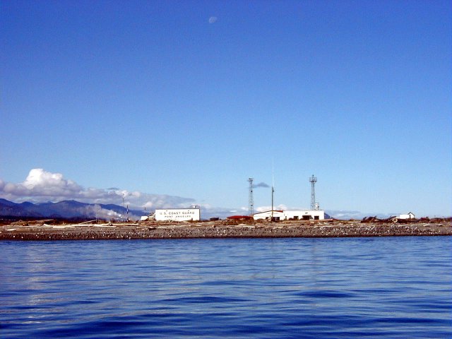
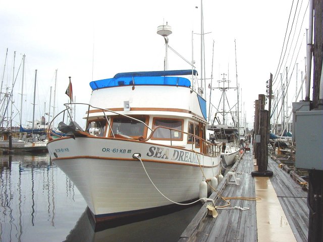
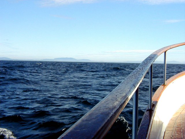
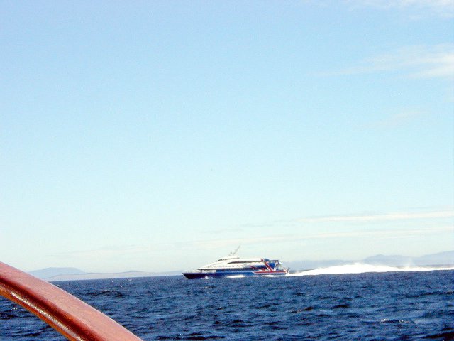
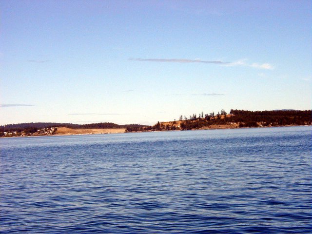
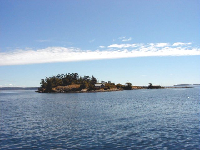
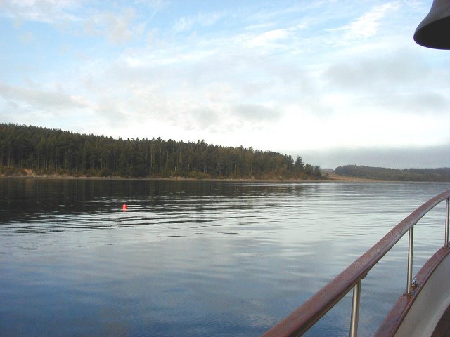
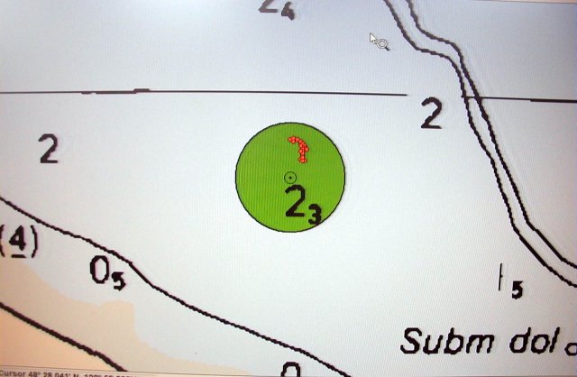
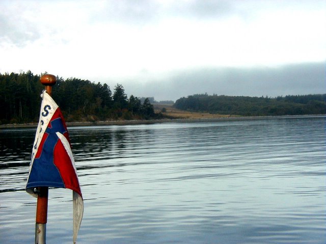
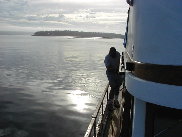
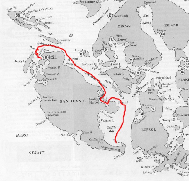
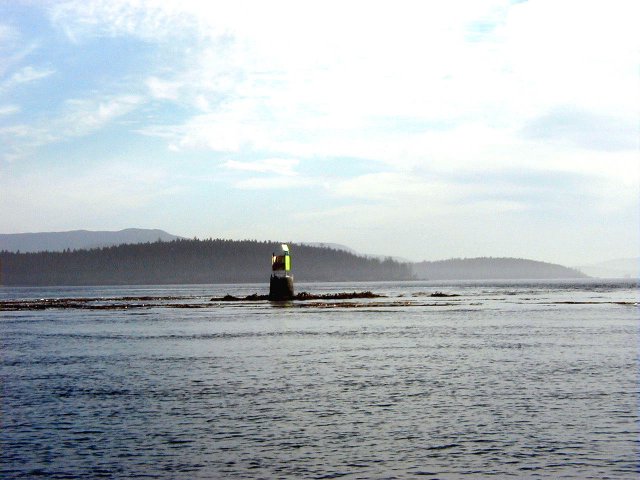
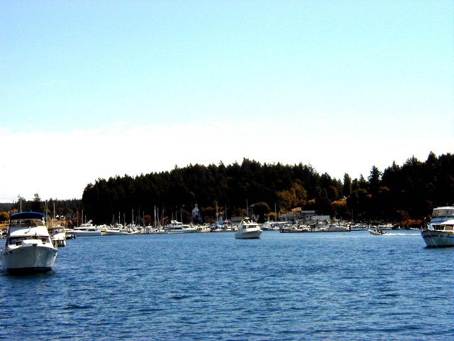
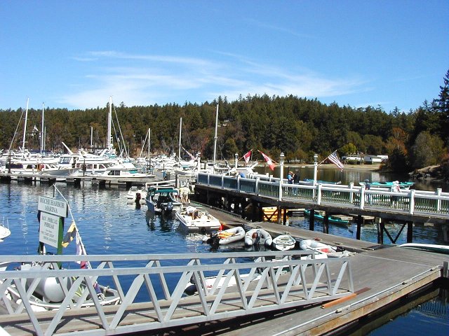
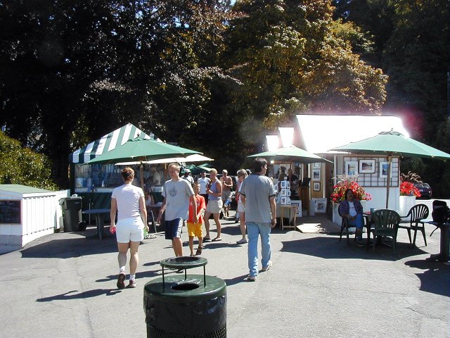
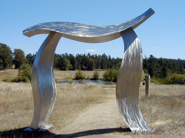
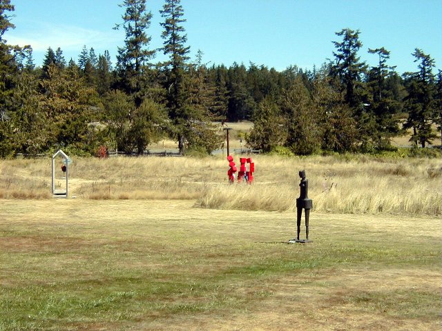
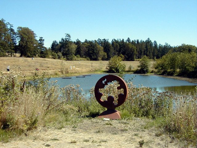
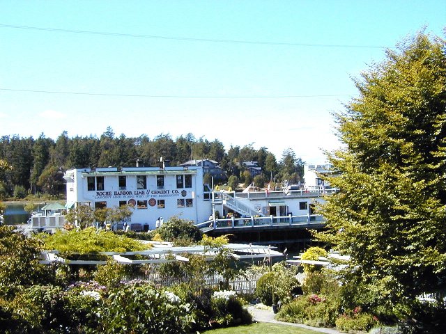
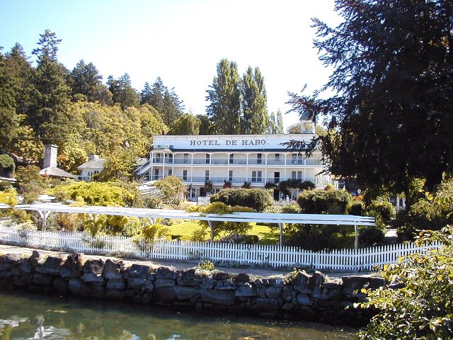
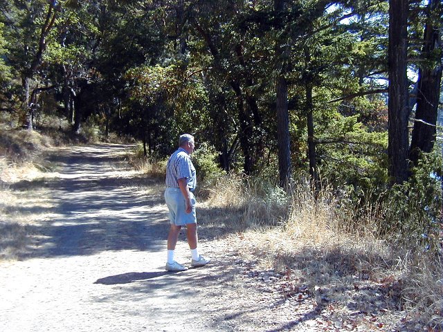
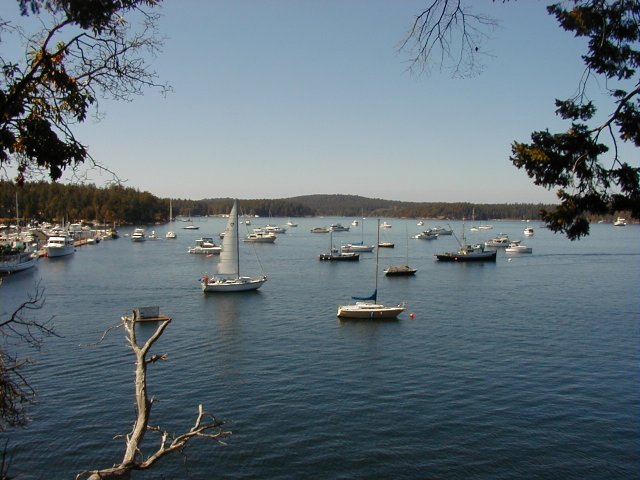
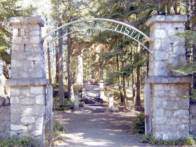
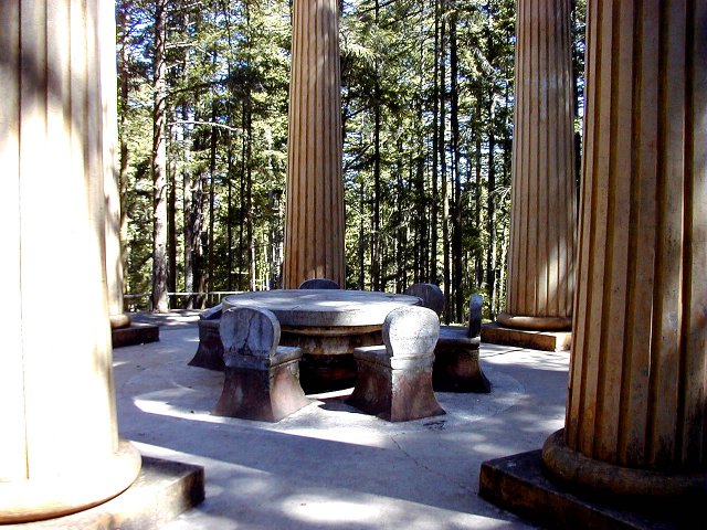
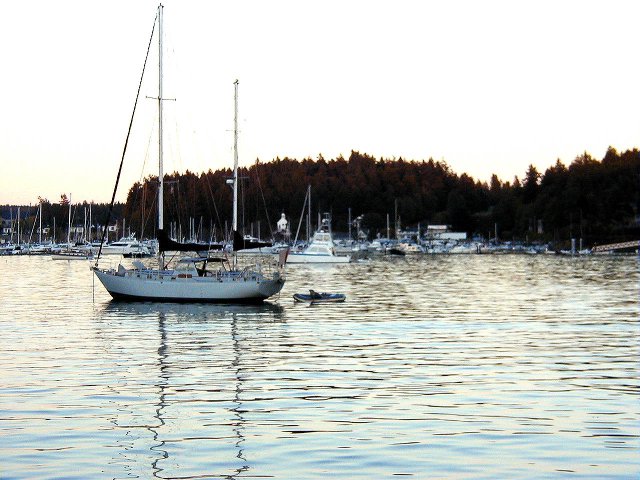
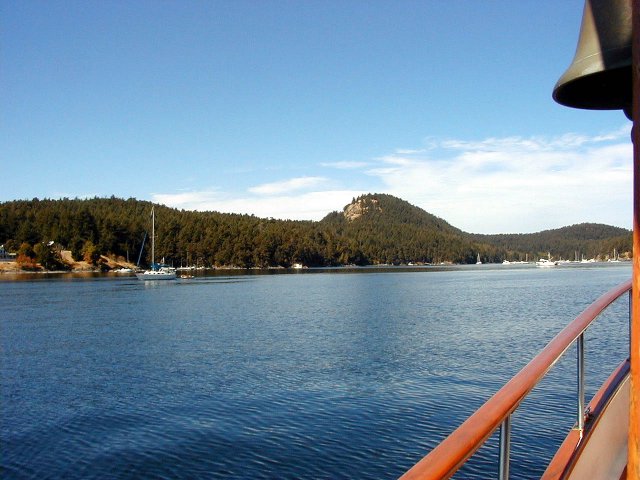
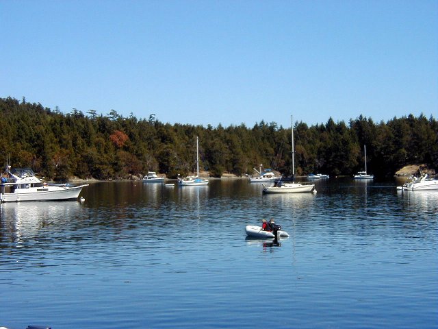
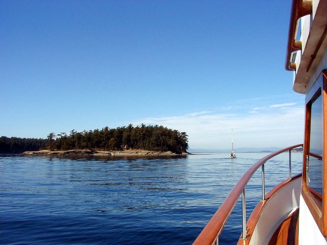
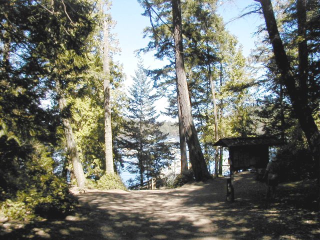
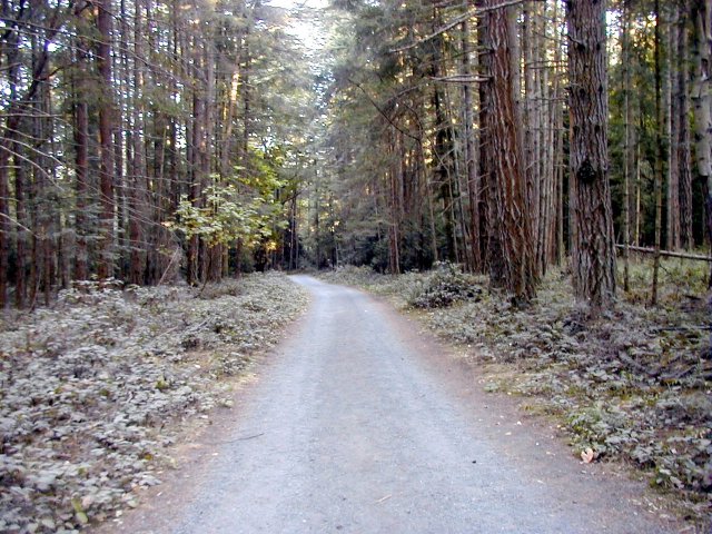
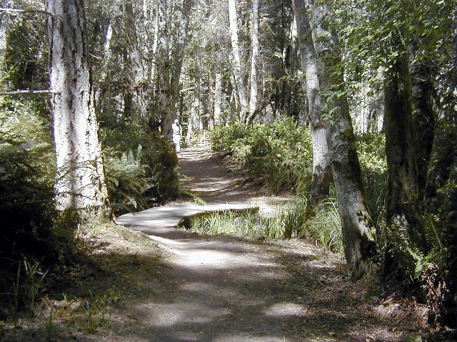
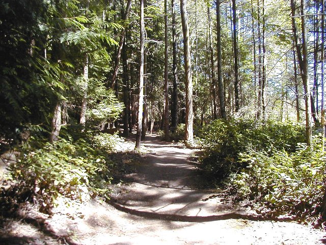
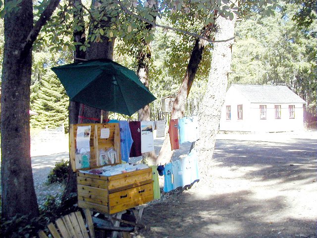
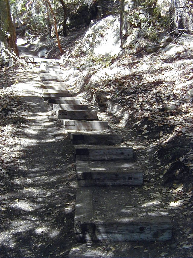
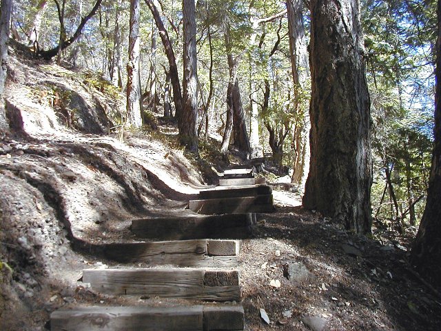
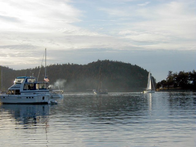
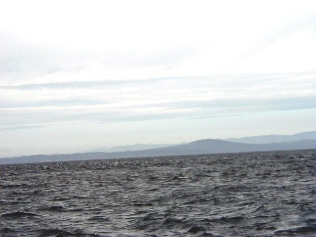
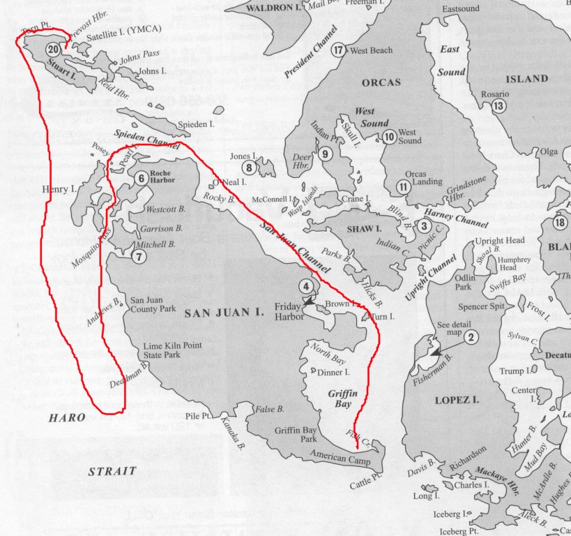
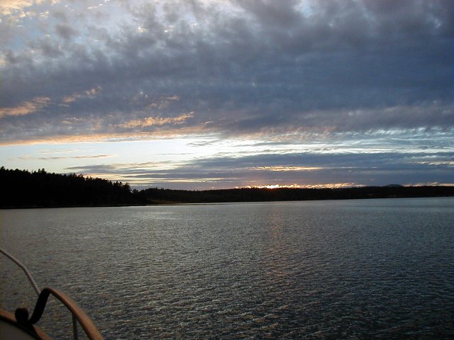
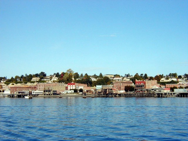
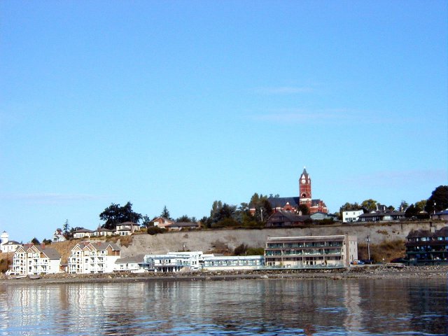
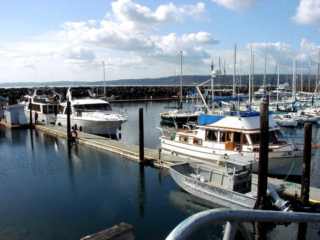
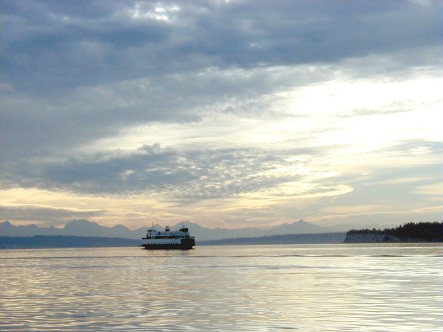
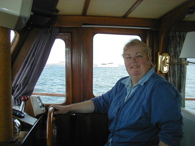
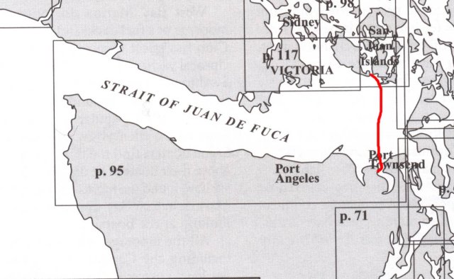
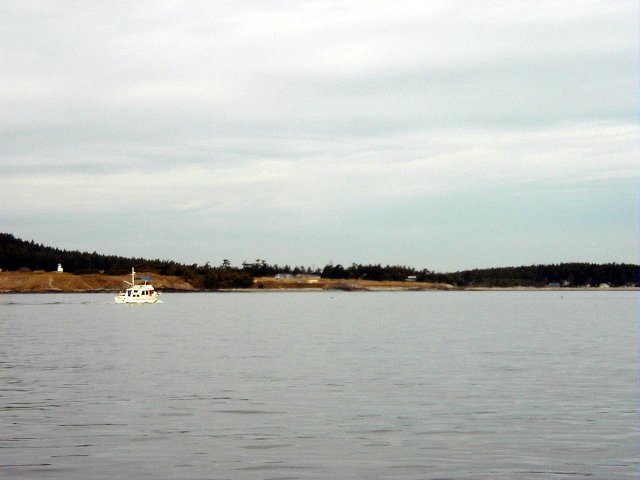
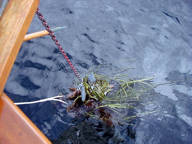
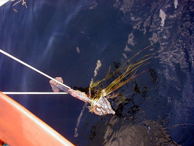
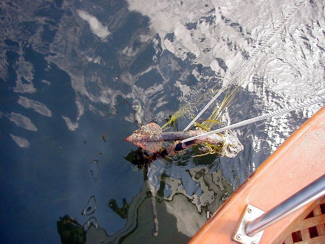
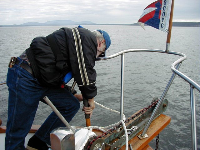
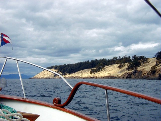
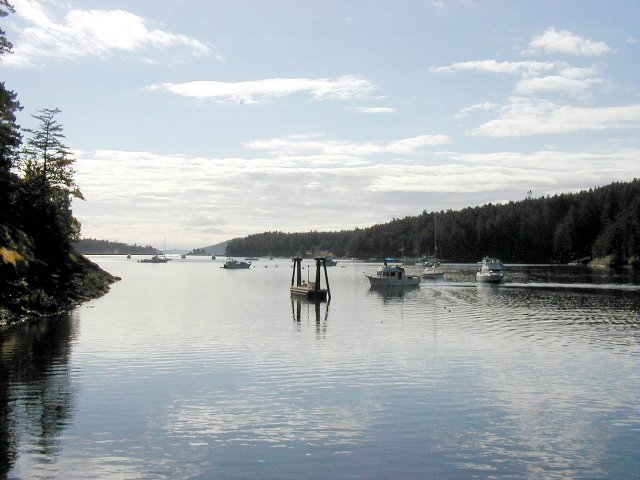
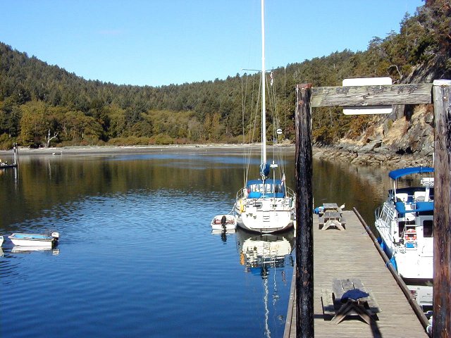
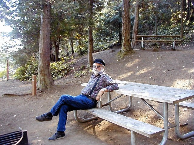
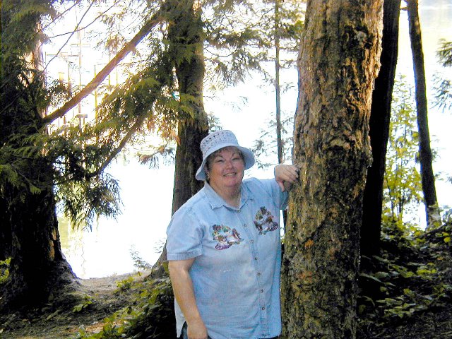
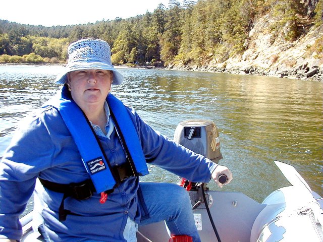
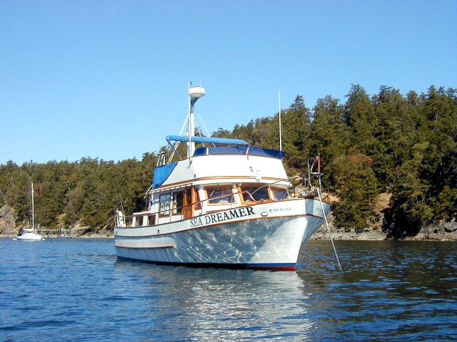
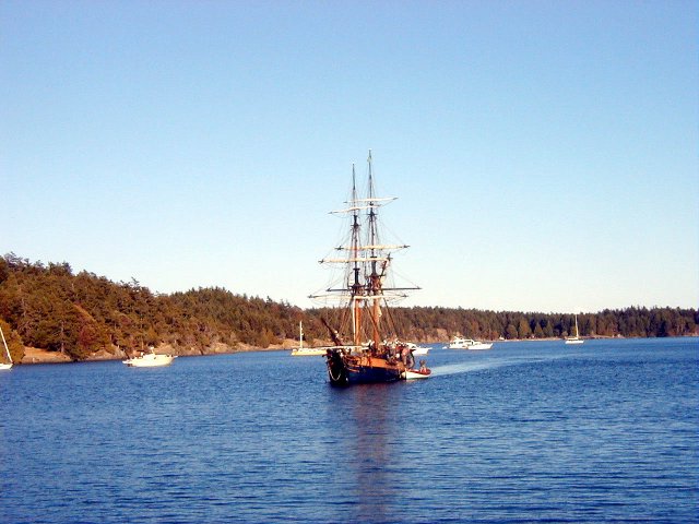
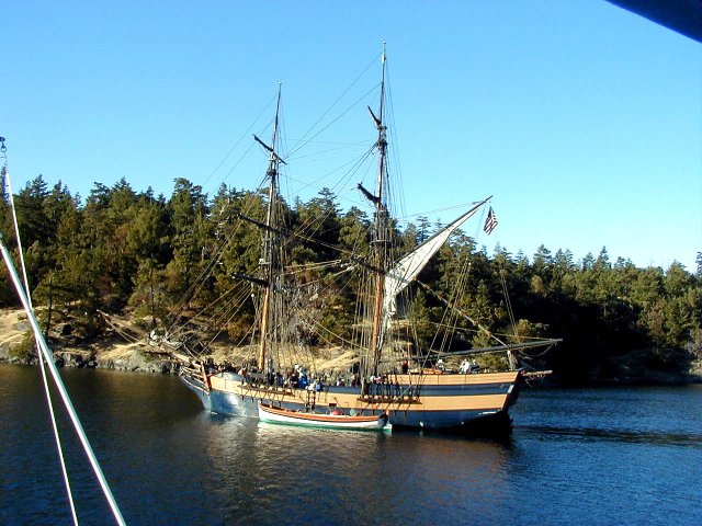
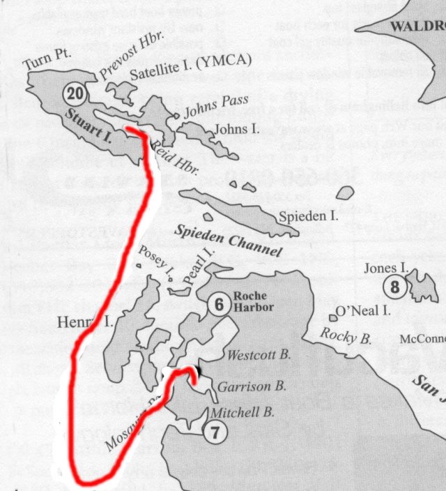
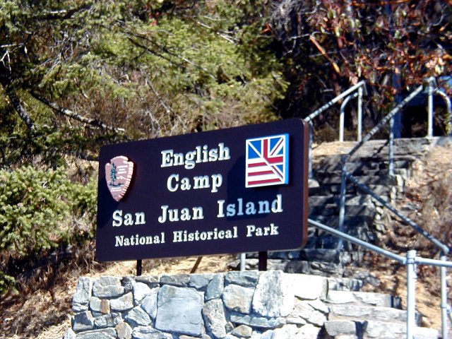
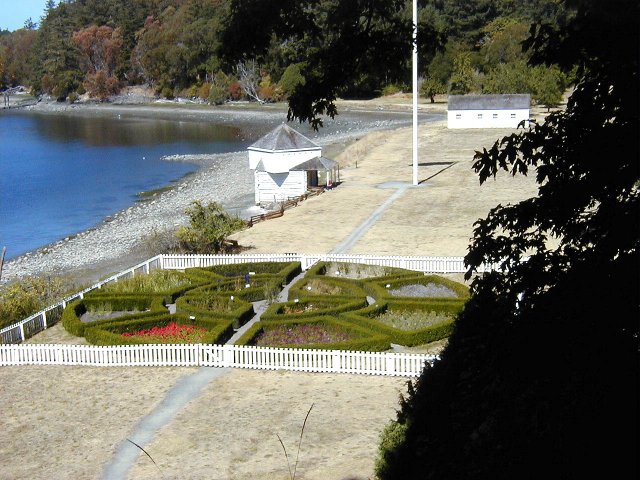
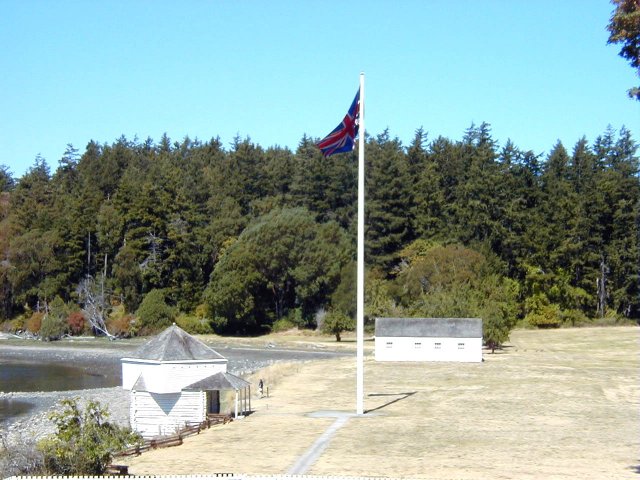
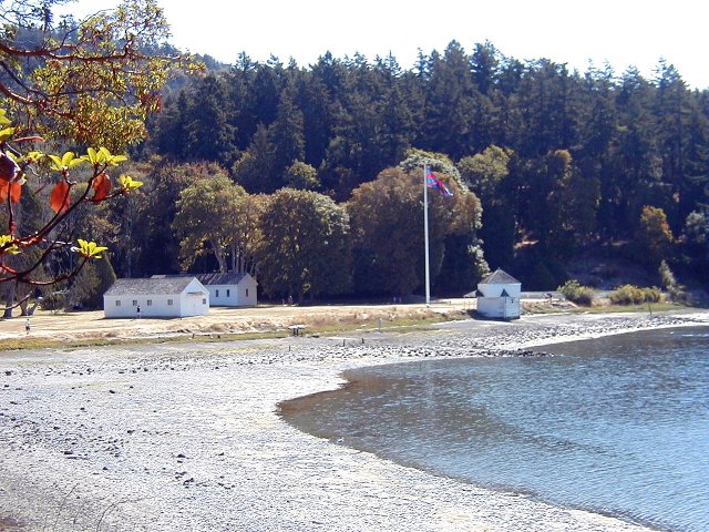
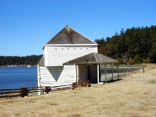
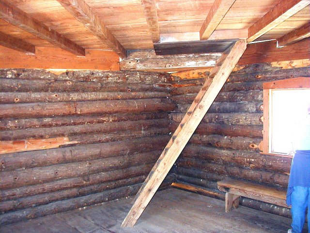
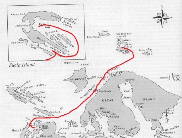
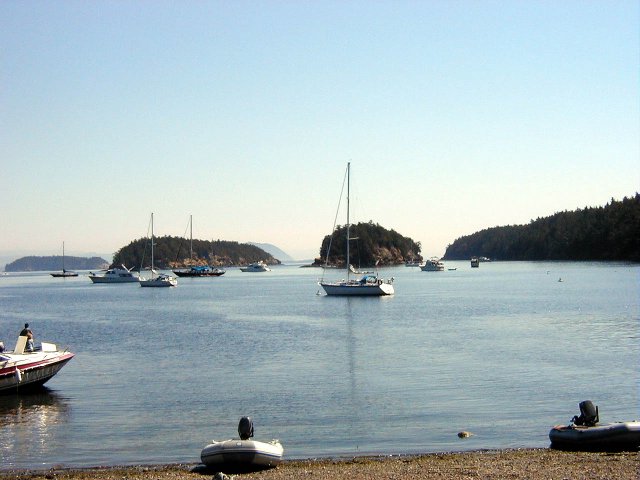
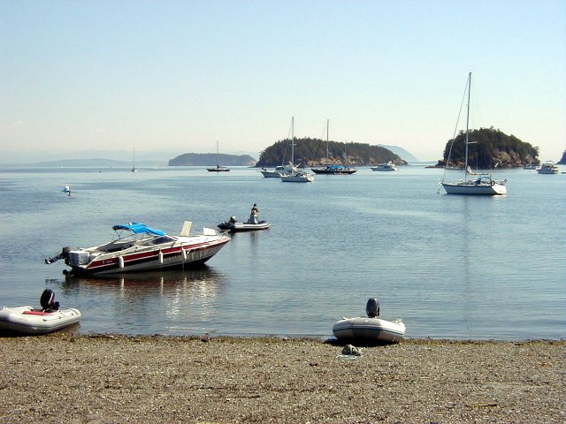
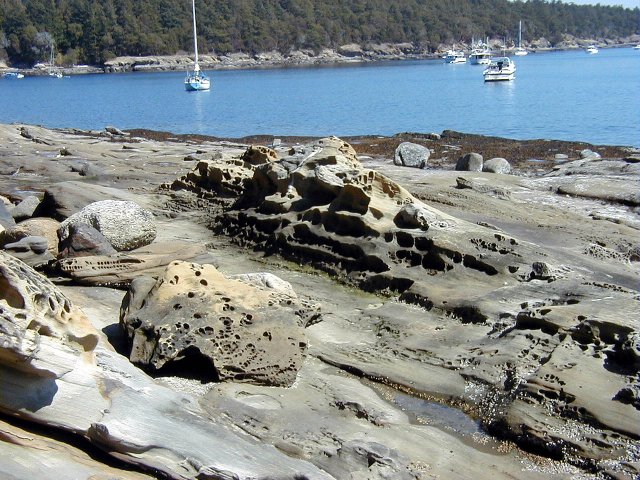
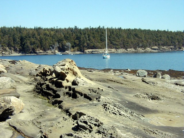
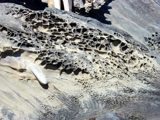
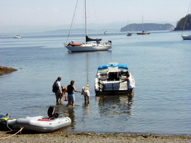
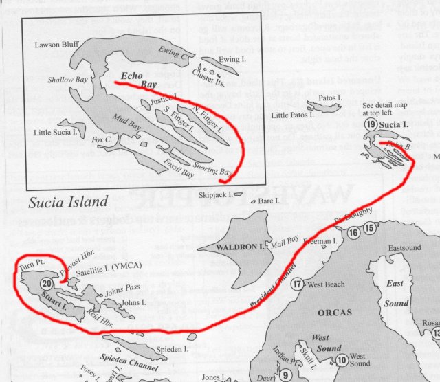
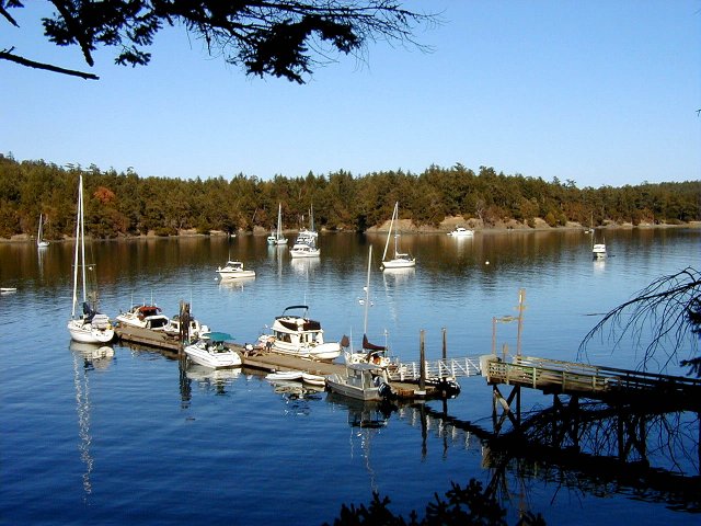
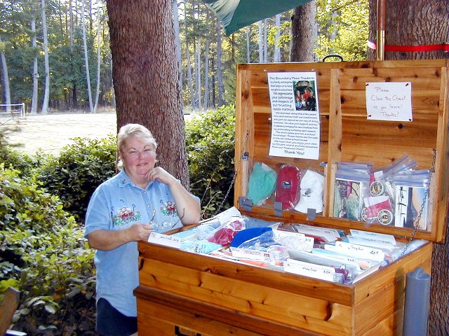
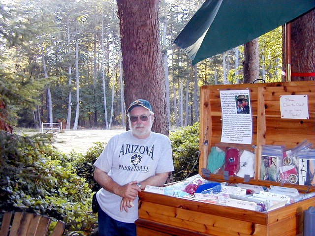
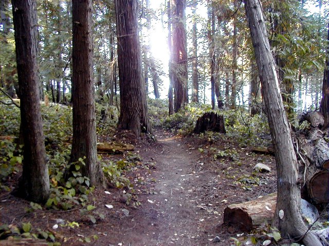
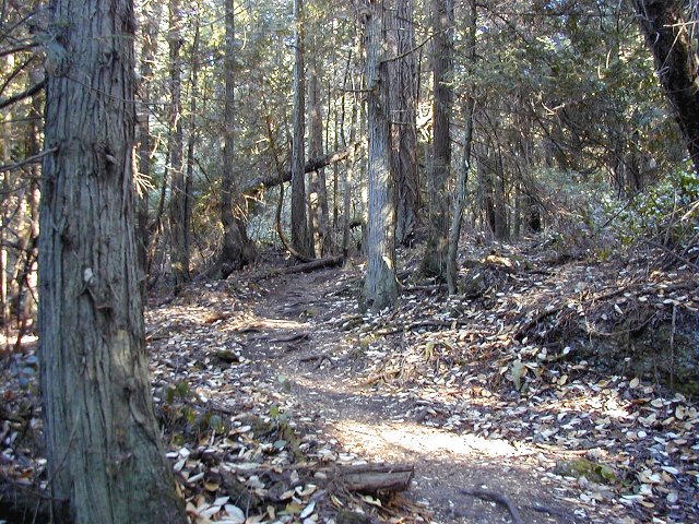
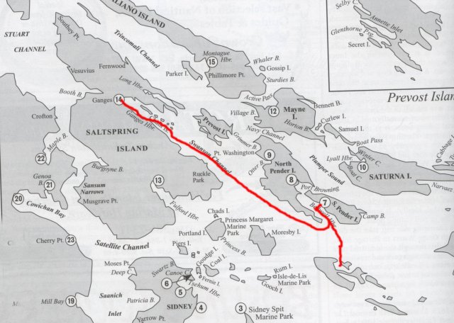
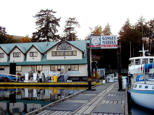
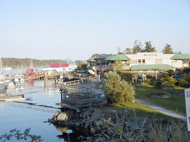
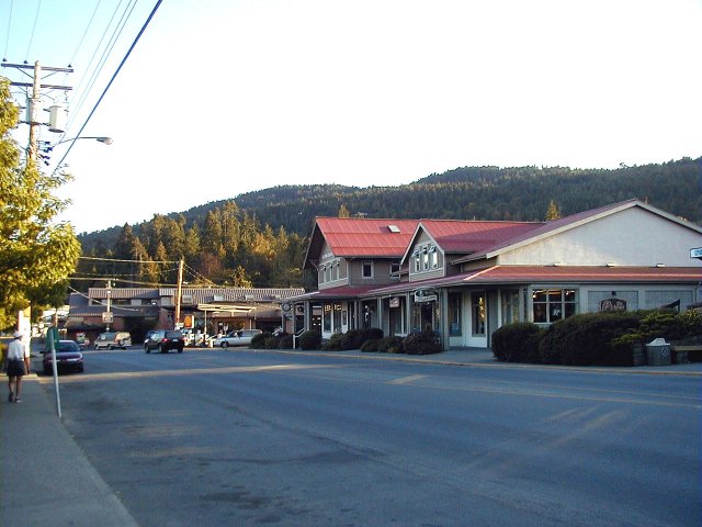
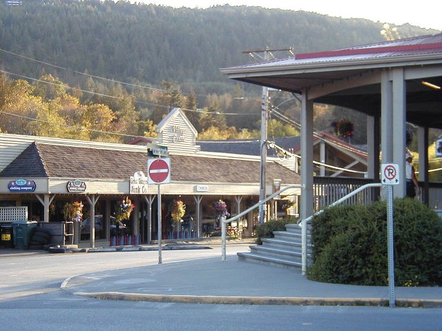
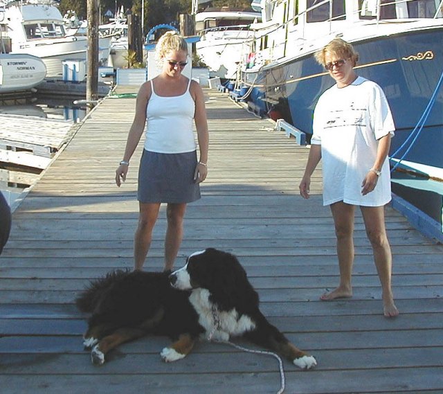
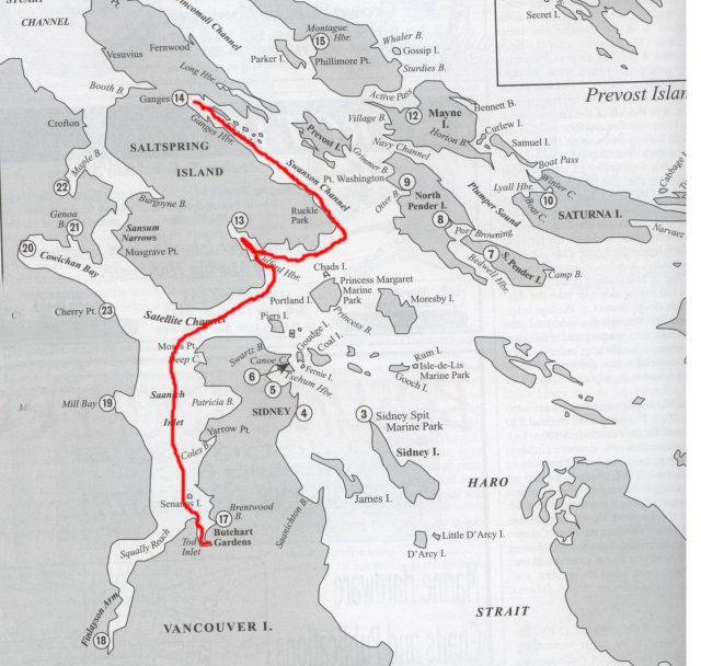
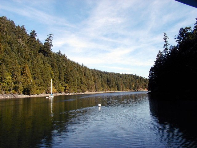
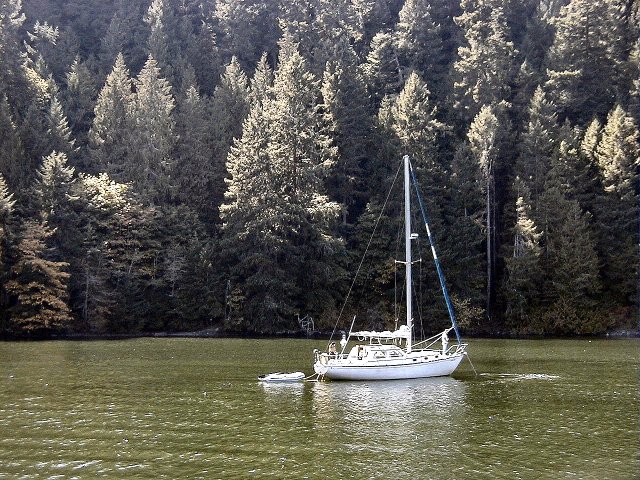
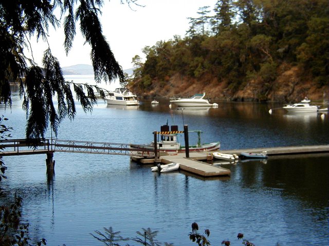
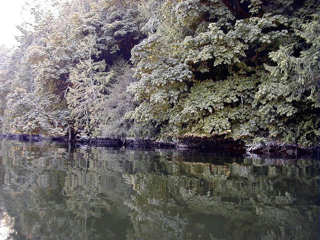
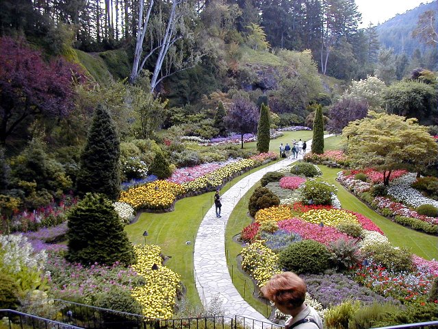
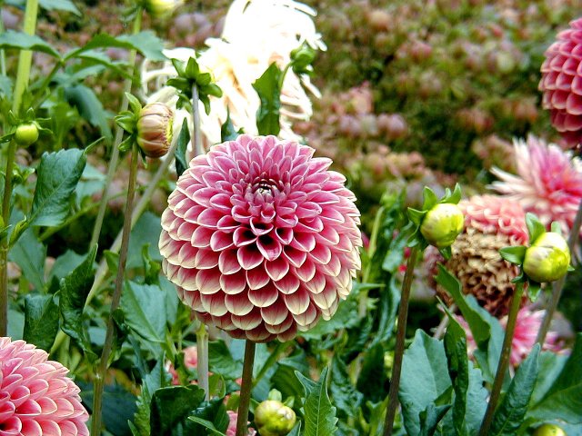
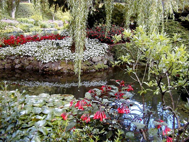
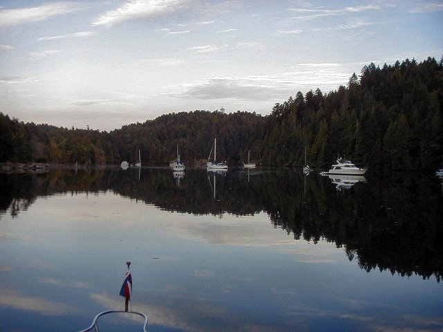
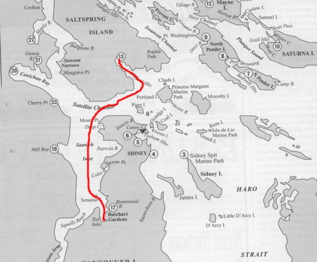
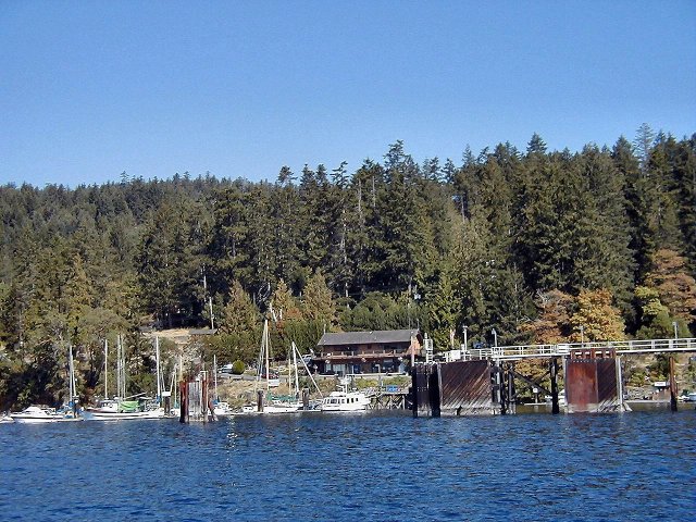
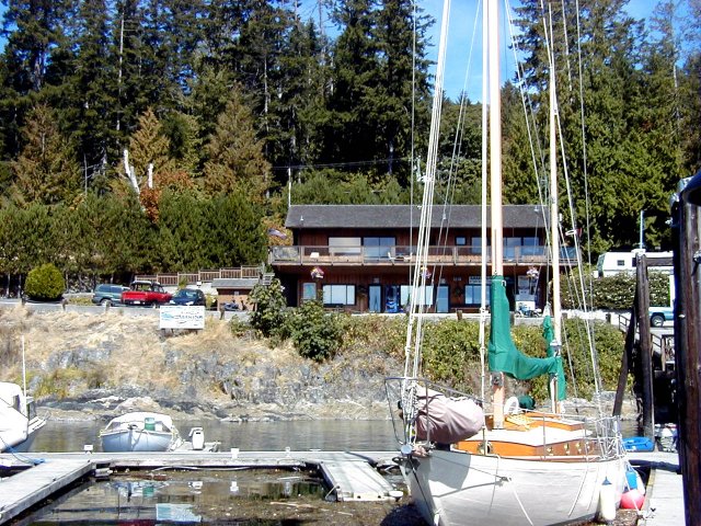
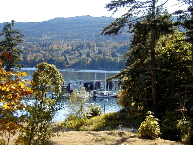
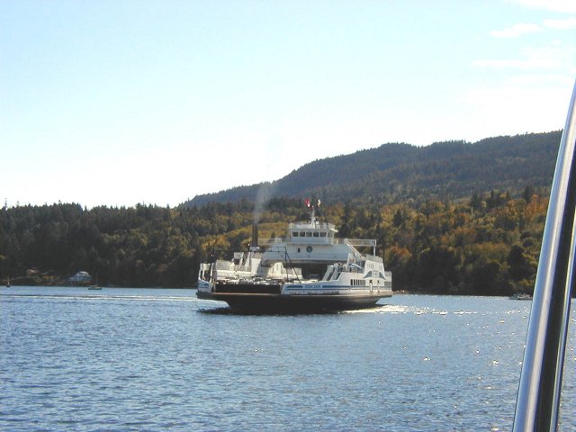
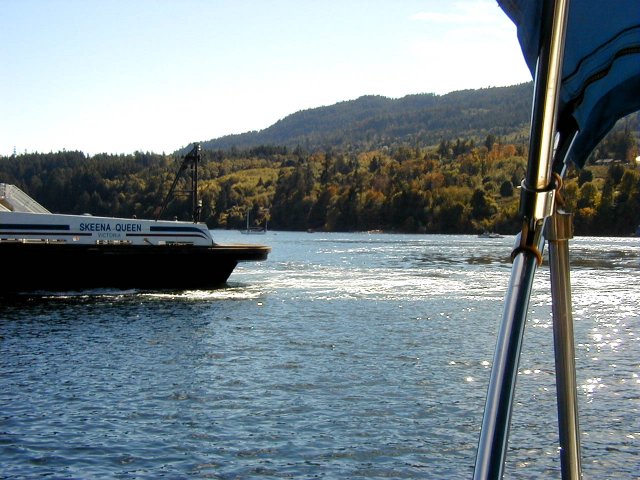
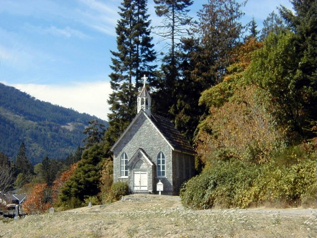
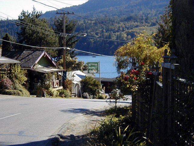
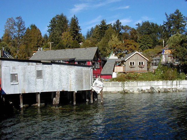
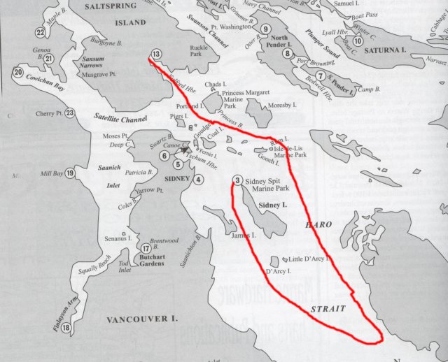
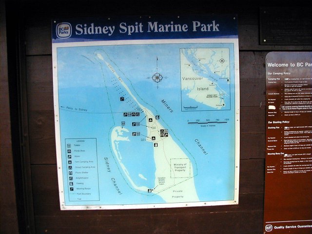
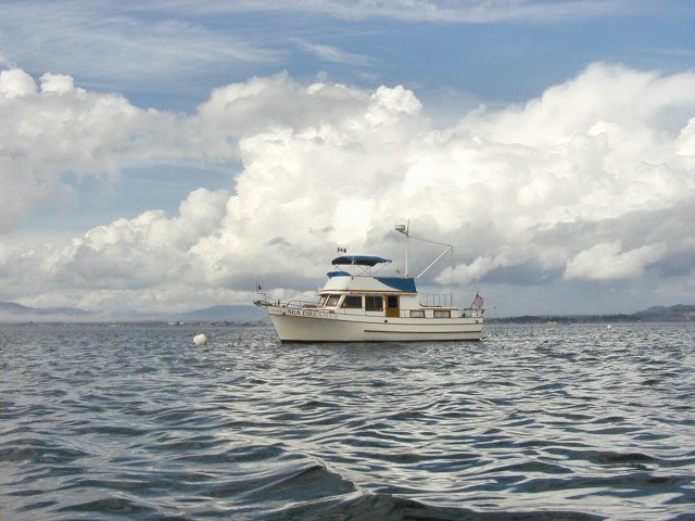
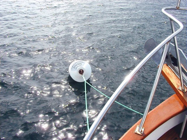
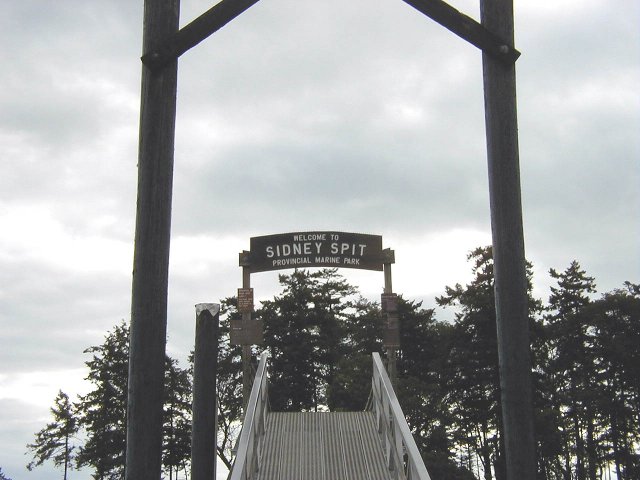
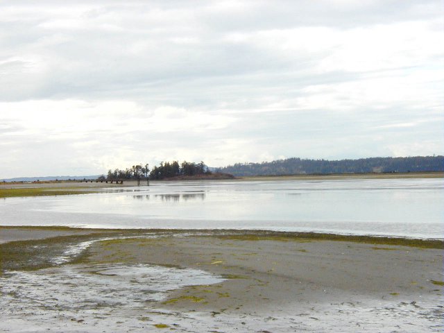
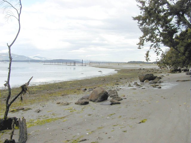
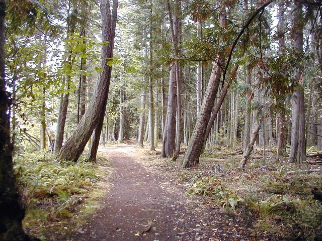
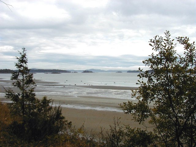
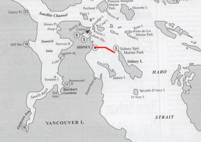
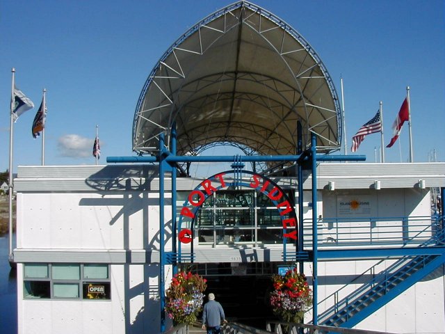
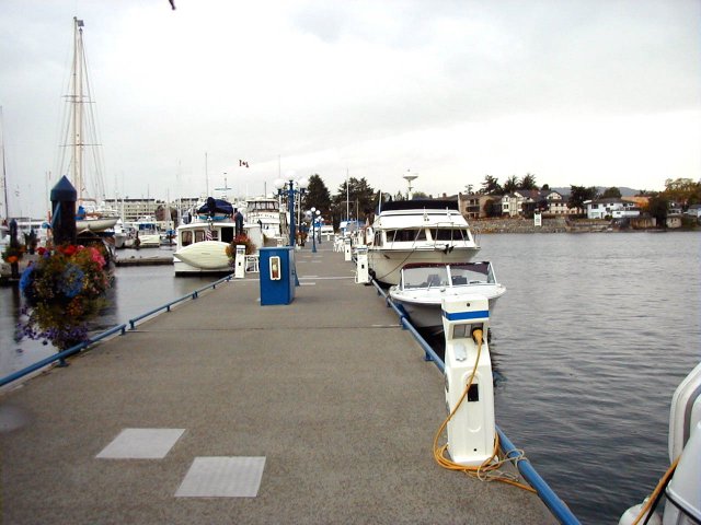
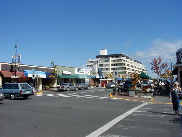
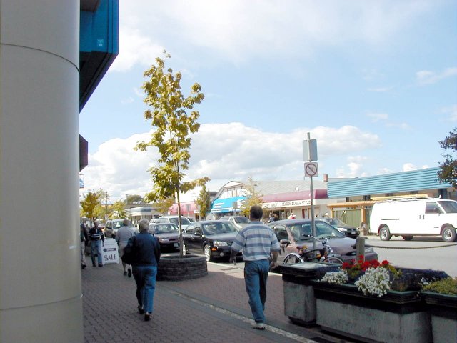
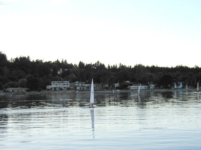
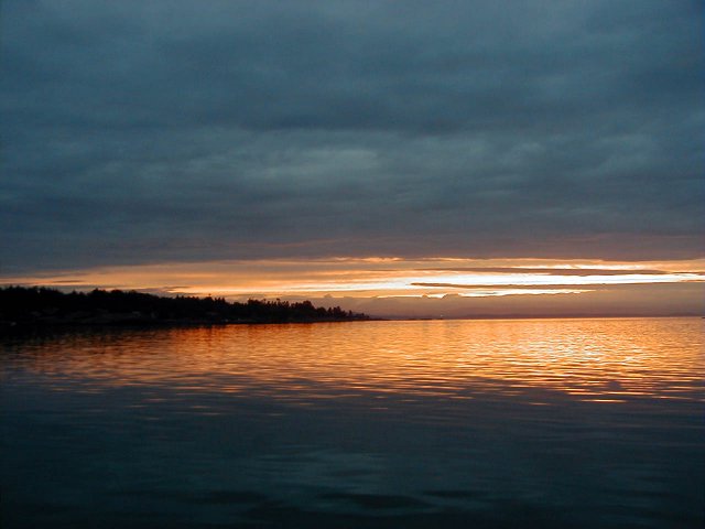
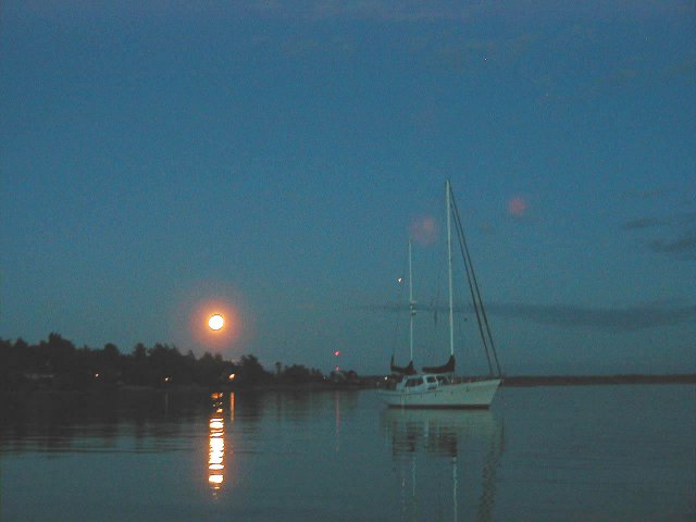
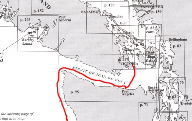
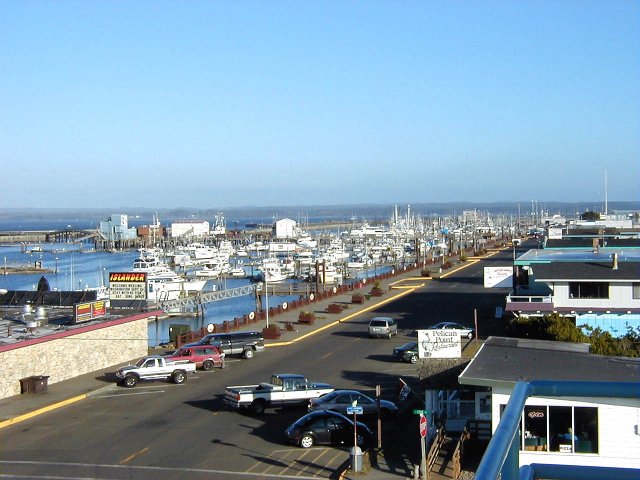
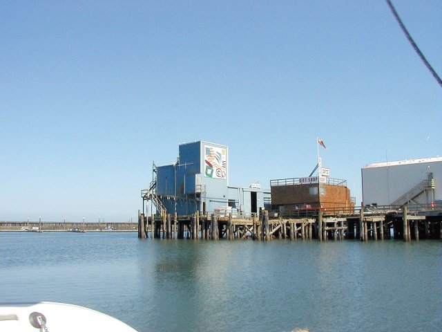
This is the story of our trip to the San Juan Islands. It was written for friends and relatives who may not know anything about boats or cruising. Click on the underlined words for pictures, use the back button on your browser to return to the story. My main purpose of this trip was to enjoy and relax so I may not have pictures of everything we did. I hope you enjoy what I have done and stay tuned for the 2004 trip. Winds were light from the south when we left Coos Bay Oregon, the morning of August 14th 2003. Hans Arnold, a friend from an earlier trip was along as crew. We made good time in calm seas and had no problems other than the port engine dieing unexpectedly about 1500. It would restart and run fine for about 30 to 40 minutes then die again. I assumed that it was the fuel filter and changed the primary filter, my assumption was correct, we had no further trouble. It was not a pleasant job as we left one engine running to give us steerage way, but the seas were not very high so we didn�t move around much. I changed the filter and bled the fuel system without any problems. We carried on that night and pulled into Grays Harbor Washington about 1130 on the 16th. We refueled and took on 141.9 gallons at $1.28 per gallon. I also bought two additional fuel filters, just in case. As the day progressed the summer fog bank started to form. The rest of the trip was uneventful. That night about 0100 in the morning I was on watch, I was standing in the doorway looking for a tug & tow that was on the radar in a dense fog and I remember thinking to myself that it just doesn�t get any better than this. That�s when I knew I was insane. We rounded Cape Flattery about 0300 in the morning. The trip down the Straits of Juan de Fuca was smooth but foggy. Looking astern in the morning we saw a "fog bow" and toward the Washington shore a thick fog layer. We decided to put into Port Angles WA to rest before going on. We arrived about 1100 in brilliant sunshine after making most of the trip through the Straits of Juan De Fuca in the fog. We spent the day resting, charging batteries and refilling water tanks. Hans decided we needed to have a restaurant meal so we took off for town. There was a caf� just outside the marina but they were closed on Sundays. Someone inside heard us trying the door, and directed us to town. �Left at the Y and then four blocks.� What she didn�t say was that they were BIG blocks. We eventually found our way to an open restaurant where I had a very good Reuben but it was a lot of work. Back at the boat we turned in early so we could get an early start crossing the Straits, the wind was due to come up in the afternoon and I wanted to get across before it got rough. The next day the 17th we left at 0700 and headed for Cattle pass between San Juan and Lopez islands. The crossing went fine although the wind was up to 15 knots as soon as we left Port Angles. On the was across we met the Victoria ferry. According to our radar it was doing about 35 knots. We had a one knot ebb current in the pass that kicked up a little chop but nothing serious, we were through by 1230. We turned into Griffin bay, on San Juan Island, to have a look around, we cruised up to North Bay and back to the southern end. I started to go around Dinner Island on the way back but chickened out at the last minute, too many rocks and shallows. Back at the south end of Griffin bay we found an area of two to three fathoms with a mud bottom that looked very inviting. We dropped the hook at about 1400, and set an anchor watch. After putting the motor on the dinghy we took a ride around the area and up to Fish Creek, the local residential area. Returning to the boat we relaxed for the rest of the day. We only had one other boat in the anchorage with us. Griffin bay is an often overlooked spot when you are on the way somewhere else. The next day, the 18th, after a quick wash down we departed Griffin bay to travel around San Juan Island. We sailed north through the San Juan Channel, south of Shaw Island looking in on Friday Harbor. Lots of boats, a ferry dock, dinghies everywhere. Way too busy. We continued on north through Spieden channel and on to Roche Harbor. We found a place to anchor about 1130. Roche Harbor reminds me of Avalon Harbor on Catalina Island. Lots of boats coming and going, dinghies buzzing around everywhere, sea planes landing and taking off, it�s great. We took the dinghy to the dinghy dock and walked around some, trying to find a mausoleum that is supposed to be back in the woods somewhere. We didn�t find it. We did find a field containing a bunch of ,sculptures(1,2). We visited the grocery store for beer and bread, the two necessities of life. We returned to the boat in our dinghy. There is a church here that plays bells at noon and at 1800. At sunset they have a flag lowering ceremony with music and a cannon that fires. All the boats in the harbor sound their horns� you have to be there. We decided to stay another day in Roche Harbor and I was determined to find the mausoleum. We went ashore for lunch, Hans is a fish and chips fanatic so we went to the Madrona bar and grill for f & c. I stopped at the hotel and obtained a map to the mausoleum, we still took a wrong turn and walked a mile or so out of our way. We did get a great view of the harbor and I took some nice pictures. We finally found the mausoleum,1,2 and I took several pictures of it. Back at the boat we had to run the generator for several hours to bring up the house battery. With a freezer, refrigerator, and computer running most of the time it runs down pretty fast. That evening I noticed one of the nearby boats had an inflatable dinghy tied to its stern, and there was a harbor seal in it. The seal was laying on the tube looking around like it didn�t have a care in the world. It eventually went back into the water and I don�t think the people on the boat ever knew it was there. The next day the 21st we got underway for Stuart Island. I wanted to cruise some and charge the batteries so we went up to Morsby Island on the Canadian side. We didn�t go ashore anywhere, just cruised around. Back at Stuart Island we went around John�s Island and into Reid Harbor. I had decided earlier, for no good reason, to stay in Prevost Harbor on the north side of the island so we left and went through John�s pass, a narrow channel between John�s Island and Stuart Island. I have no idea who these people were but they have islands named after them. Both harbors have docks and are only about 100 yards apart. I had heard of the Stuart Island �Treasure Chest� before this trip. It is a fund raiser for the local school. They fill a �Treasure Chest� with items that would appeal to tourists, T-shirts, hats, stationary, etc and use an honor system to collect payment, take an envelope and send in your money. From the anchorage you go ashore to a state park, very nice with a composting toilet and water available. From the park you walk out to a county road and then .7 miles to the school. The only problem is that Stuart Island is very hilly, seriously hilly. Along the path out of the park is an area of about 100 steps. We met a couple just before we got to the steps who told us about a short cut that avoided the steps. Never trust someone with a �short cut�. I�m sure we climbed at least a 1000 feet to get to the other side of the hill, that may be an exaggeration but it sure felt like it. We walked through dense forest, it was very warm and I am out of shape. We eventually found the right place, I took a t-shirt and a hat for my trouble and then we hiked back. This time we didn�t take the �short cut�. The steps were hard but it was still easier than the other way. After our hike I declared the showers open. Even after our showers we still have plenty of water to go until we get to Port Townsend on Saturday to pick up my wife, Karen. You can always tell when it's dinner time by the BBQs lighting off. We left Stuart Island the next day for Griffin Bay to await a crossing of the Straits. Karen was driving up on the 24th and we wanted to get there a day early. I decided to go around through Haro Strait in hopes of finding Orcas. We did see a pod of Orcas but we also found a heavy current and steep chop against us. We persevered until the boat speed slowed down to three knots and I decided to turn back. Instead of going all the way around the north end of San Juan Island I went through Mosquito pass. Mosquito pass is a short cut between Henry Island and Roche Harbor, it is also very narrow and winding. We followed a string of boats through and had no trouble, we did look like a conga line though. There are lots of boats up here during the season, you can usually wait for someone with local knowledge to go first in any questionable area. Once out of Roche Harbor in Spieden channel we found more Orcas. We continued around San Juan Island to Griffin Bay where we found a spot out of most of the wind to anchor. I decided to use the cannonball and the bridle since the wind was blowing 15 to 20 knots. A cannonball is a weight that attaches to the anchor chain and helps the anchor hold. It was blowing the same in San Juan Channel and gale warnings were up for the straits. Griffin Bay is only separated from the straits by about half a mile of fairly low land so we had a fair amount of wind. The water was still calm however. The wind was supposed to moderate overnight and an early departure the next day looked feasible so we planned on being underway by 0600. 0530 comes very early around here. It was just getting light when we got underway for Port Townsend WA. There was a little ebb chop coming out of Cattle pass but it settled down after a few miles. The weather report was right for once and we had little wind. The trip across was uneventful. Arriving at Port Townsend1,2 we radioed ahead for a slip and I think we got the last one available. The fuel dock was the first stop. We had to queue up and wait for the only pump they had, and it was a very slow pump. Three boats were ahead of us so it took some time. I registered at the office while we waited. We finally had our turn, I took 173 gallons at $1.51. After fuelling we headed for our slip. I was on the bridge and made one pass at it when the gear shift linkage to the port engine broke. That was bad enough, but the engine was in reverse when it happened. I quickly ran to the lower helm station to see if it would work there and luckily it did. We got in with one minor collision with a piling that will require some varnish work but no other damage. On investigating I found the linkage cable from the bridge to the lower station broken. I removed the cable and went to a West Marine store in town but they didn�t have any the right size. I called Karen to check at Englund Marine back in Coos Bay and they had the right one. She will bring it when she drives up tomorrow. In the meantime we have plenty of water to clean with so I gave the boat a much needed hosing. A trip to Safeway and the Laundromat completed our day. Karen arrived on Sunday the 24th with supplies and the engine cable, and we prepared to get underway on Monday the 25th. Monday dawned clear and sunny. Hans departed in the car for Charleston and Karen and I got the boat underway for San Juan Island. The crossing was uneventful with calm winds and glassy seas. We saw ourselves often in these islands. I had timed the crossing so that we had favorable currents on both ends of the trip and we made good time. One of the things that make life easier up here is a good tide and current program on the computer. There is very little wind in these islands and almost no rough water, but the currents can run very strong. There is a nine to ten foot tide in this area and that�s a lot of water to move twice a day. It can take a lot of power and fuel to try to buck a strong current. There are also tide rips to deal with. That is an area of rough water and strong currents due to the tide. I have also seen whirlpools form. It�s a good idea to avoid strong currents whenever you can, it�s sometimes faster to wait than to buck the current. We were through Cattle Pass and anchored in Griffin Bay by 1100. The dinghy was launched and the motor mounted so we took a short dinghy ride over to the park near half-tide rock. That afternoon we enjoyed watching the seals jumping and putting on a display. I don�t know what they were doing but I think it is some kind of courting display. Some jump out and come down with a big splash and others swim on the surface and slap the water with their fins. The next day Tuesday I worked on the control cable and got it in with no problem. We had quite a bit of trouble pulling up the anchor that morning. It had been quite windy the night before and I had been up a couple of times to check on things so I assumed that the anchor was really buried deeply. After a few minutes it was apparent that something was wrong. The windlass was really straining and I was afraid it would burn out. I used the hand lever to get the anchor up to the surface. It was caught in another anchor. An old style fisherman�s type that had been there for years. It looked like it was about four feet across and must have weighed at least 100 pounds. If I had any way to bring it aboard or to carry it I would have tried to keep it. I had a bitch of a time getting loose from it. It took several lines and a lot of work with the boat hook to get free. The only harm done was a minor cut on my finger when I got it caught in the windlass. Just in case I get a chance to go back I marked its location on my chart. I don�t know what I would do with it but some decorator might pay a good price for it. We cruised around the east side of Shaw Island, through Wasp Passage and Spieden channel to Ried Harbor on Stuart Island where we anchored for the night. The day dawned bright and sunny on Wednesday the 27th. We went ashore and walked around the state park but did not feel up to going all the way to the school. Played around in the dinghy some and returned to the boat to charge batteries. It takes about three hours of generator time to keep the batteries up. That afternoon the Lady Washington, a two masted Brig, came in. They went up to the dock and discharged some passengers then anchored right next to us. Later that evening, after dark, their long boat full of young people and three guys with torches rowed ashore. I don�t know what they were doing and never heard them come back. Garrison Bay was the next stop. We left Reid harbor and went down the west side of San Juan Island to Mosquito pass and up to Garrison Bay and English Camp. This was the location of the English Garrison during the pig war of 1859. No actual shots were fired and the Americans and British visited back and forth for several years. This was the period that determined the ownership of the San Juan Islands. It was finally decided by Kaiser Wilhelm of Germany who awarded the islands to the US. They have a formal garden and some of the original buildings are restored,1,2. Roche Harbor is just around the corner so we went on in and anchored. We fortified ourselves with some ice cream cones and went on to the sculpture garden and the Mausoleum. There were some Hippy wannabe�s there singing and carrying on. We walked around some and left. The next day, the 29th we went to the island of Sucia, Fossil Bay our first choice, was crowded so we went on to Echo bay. The first time we tried to anchor it wouldn�t hold. We lost a chain hook trying to get the anchor set. I think the anchor caught on a rock and the chain on the hook wasn�t heavy enough. Most of the anchorages up here are sandy mud and very good holding, at least for the winds they have. We moved further into the bay and anchored without problem. The anchorage is open to the southeast, and it was a little rolly, if I had a flopper-stopper I would have used it. We decided to only stay overnight and look for a smoother place the next day. We took the dinghy ashore and walked around some. The sandstone rocks were eroded into some interesting shapes. We looked into a few tide pools, but most were not deep enough to hold anything. I saw a few gobies about an inch long in one but that�s all. We spent some time watching people come and go from the beach, almost as much fun as watching a launch ramp. Everyone has a different style for getting in and out of a beached dinghy, including us. Most of the places we have stayed have a dock you can bring a dinghy up to, much easier to get in and out that way. We spent a peaceful night without rolling around too much. The real world has a way of intruding and I needed to mail some bills so we returned to Roche Harbor on the 30th. We took mail and trash ashore but didn�t go anywhere else. We didn�t want to stay there again so we left as soon as we got back to the boat. Stuart Island was a nice place and close, so we decided to stay there again, this time in Prevost Harbor on the north side. The harbor quickly filled with boats for the Labor day weekend and swinging room was tight. I ended up with very short scope on my chain. We tried to varnish the rails on the bridge but we couldn�t sand enough of the old finish off by hand. Karen gave the cushions a good scrubbing. That afternoon we went ashore and walked to the �Treasure Chest�,1. It is about a 2.5 mile hike with a set of 129 steps to climb. We were tired by the time we got home again. September 1st dawned with about a 15-20 knot wind blowing through the anchorage at Prevost Harbor, everyone held or pulled up and left. The wind died off in the afternoon and the usual calm returned. The anchorage was almost empty, there were only 17 boats in the cove. It was Labor Day Monday so I guess everyone left for home. By evening it had filled up some but nothing like it was on Sunday. We went for a hike that afternoon, the trail we took was marked �difficult� but it wasn�t so bad. It took 45 minutes to do a mile hike through the forest and up and down the hills. It was circular so we didn�t have to come back. The forest here is very nice, mostly fir trees of course with a few Madrona trees to add color. The soil is soft dirt so walking is easy although your shoes are really dusty when you get done. Tuesday the 2nd we left for Canada. The nearest port of entry was Bedwell Harbor on South Pender Island, about 5 miles from Stuart Island. There was a stiff wind blowing as we approached the customs docks but there were no other boats so I had my choice of spaces. I took a spot that the wind would blow me into and just let the boat drift into the dock. I took all the boats papers up to the office but it was closed. I found two telephones on the side of the building that connected to the customs office so I checked in by telephone. It was very smooth and easy, they asked a few questions and gave me a number to display in my window and that was it. It didn�t even cost anything. Getting underway again was not as easy as getting in but I managed. We decided to go on to Ganges on Salt Spring Island, about 15 miles away. There was still a stiff wind blowing as we entered the harbor. I called the marina on the VHF and got a slip assignment. It looks like this marina was slapped together out of surplus parts from other marinas. It goes every which way and every dock is made out of something different. The space we are in is kind of angled against the main walkway and was a real trick to get into. We will stay the night, recharge batteries and take on water. The cost for moorage was $55.64 CDN which was about $46.00 US. We walked to Calvins and had a very good lunch. I had a glass of brown ale that was almost as good as the beer in England. Walking around town it was apparent that Ganges was the Hippy Haven on Salt Spring Island. The streets were filled with little boutiques and art studios. We looked through a grocery store where they had things I haven�t seen since I left England. We spent some time cleaning the boat and taking showers. While walking the dock looking at the boats we came on a large dog laying on the dock with a couple of ladies standing around it. It turns out that they had come upon the dog while coming in. The dog was swimming about a mile and a half out in the channel. One of the ladies was watching it thinking it was a seal. When it didn�t dive at their approach she looked closer at it and discovered it was a large dog. They managed to get the dog aboard and luckily it had tags so they could contact the owner. It had fallen off the boat and was swimming after it. The owner was out in the dinghy looking for it. The boat it had fallen off of was tied up next to it and I can understand why it fell. There were hardly any rails on it and none around the cockpit. The next day we filled the water tanks and got ready to leave. I thought I might have trouble getting out of the slip, but I was fortunate that one of the boats in my way had left before me so I had more room and there was no wind. One nice thing about twin engines is that I am very maneuverable and can work tight spaces that single engine boats couldn�t. We cruised through Fulford Harbor on the way south to Tod Inlet, but did not stop. It looks like a nice place and I may stop there someday. It has a ferry terminal and according to our guide book there is at least one pub. It can�t be too bad. Tod Inlet in Brentwood Bay has to be one of the most peaceful places on earth. It is 880 yards long and 210 yards wide, about 40 acres, surrounded by mountains 800 to 900 feet high. The entrance is narrow and curves around so that when you are in, you are enclosed by the hills. It�s almost like being on a lake, the water is flat calm. The reason we are here is to visit Butchart Gardens one of the outstanding horticultural exhibits in Canada. It was after 1300 when we arrived so we will go the next day. Today we took the dinghy and examined the inlet. There are a lot of purple starfish in this water, we didn�t take any out so all I know is that they are a very deep purple. There seem to be quite a few oysters but neither one of us like oysters so it didn�t matter. We also took a trial run to the gardens dinghy dock to see how long it would take. About 10 � 15 minutes. Just anchoring in this delightful harbor would be enough to bring us back. The trees grow so close to the water that some of them have barnacles on their lower branches. Butchart Gardens were very nice, I took 90 photographs of the flowers and grounds. We walked around from 0900 to 1130 when we stopped for a hot dog. We wanted to leave and visit the butterfly gardens a short distance away but they said we could not get back in. As we had come by dinghy, we needed to return to their dock. Just after we returned to the boat the wind picked up to about 20 knots through the anchorage. As I was watching the chart plotter I noticed us moving. We were drifting down on a small sailboat at a rapid pace. We quickly raised the anchor and re-set it and had no more trouble. I didn�t see any other boat dragging but several people were out checking their anchors. The wind died off in the evening. That seems to be a pattern here. For some reason the wind comes up in the afternoon and dies off by early evening, at least this time of year. The next day we decided to go back to Fulford harbor and find a place to anchor. Before getting underway I wanted to check the batteries. While checking the battery water I noticed the backup bilge pump running but not pumping anything. It seemed to have an air lock. I cleared the air lock and looked into why it was on in the first place. The backup pump shouldn�t be on at all so I looked at the primary pump and discovered a bad connector. I repaired the connector and everything is fine. This is the second time this has happened so I will rewire the whole pump setup when we get back. Sydney was our destination but we decided to spend a night in Fulford first. We had been through the harbor once and it looked kind of interesting. It was only about 15 miles, and we arrived about noon. Coming into the harbor I checked a couple of anchorages but didn�t find anything that suited me. The wind was blowing right up the bay and it wouldn�t have been very comfortable. In the end we took a slip at the local marina. It is quite small and right next to the ferry dock. The rates were good, only about $20 US per night. Soon after we tied up a ferry came in. I was glad I hadn�t anchored. They leave the props turning while loading and unloading and there are some fascinating currents here, especially when they leave. They have side thrusters that moved a lot of water in our direction, I double checked our mooring lines before leaving. The local pub was about a twenty minute walk away, so we walked over for lunch/diner. On the way back we stopped at a small church. It was erected in 1885 and had a lot of old graves around it. After a short rest we went into town, about 15 minutes in the other direction. We walked around for a few minutes and visited a grocery store for a few supplies. The town is very small and seems to consist of mostly Hippy type shops. I wonder who buys tie died shirts in the winter. Back on the boat we tried out some dehydrated hash brown potatoes I had purchased before I left Coos Bay. They turned out to be pretty good but need to be reconstituted about eight hours before use. The ferry came in about 2130 and stayed the night. It must have gotten underway at 0600 the next morning but we didn�t hear a thing. It was gone when we got up. We took a short walk to the Fulford pub for breakfast. At first they weren�t sure we could eat there without being guests of the inn but the manager said it would be ok. Back at the boat, it was showers, and filling the water tanks and we are ready to go. We had to wait for a ferry to leave before we could get out and we were underway at 1100 on the 6th. I had it in mind to cruise down Haro strait in search of Orcas but we didn�t find any. We went a little ways past Smallpox Bay without seeing any. That put us south of Darcy Island and its reefs so we headed north up Sydney Channel towards Sydney. About the time we got into the channel it started to rain. We had some lightning but none real close. Not very many boats get hit by lightning but it is still a scary experience to be the only object that sticks up in the middle of a thunderstorm. Sydney Island was supposed to have several mooring buoys so we thought we would take an extra day before going into Sydney itself and try one. I haven�t used a mooring buoy since Catalina Island but we had no problems. They have a ring on the top that you pick up with a boathook and pass a line through. It has been raining on and off since we moored but it is calm behind the island. We will head for the town of Sydney tomorrow. About 1830 the park attendant came out in his boat and collected $10.00 CDN for the mooring buoy. The next morning we went ashore to check out the park. It is very nice and mostly level, unusual for the islands up here. We walked along the beach some and took a 2 km walk around the park. Karen spotted two deer on our walk. According to the signs, the deer swam over here from an adjacent island in 1960. How do they know that? After our walk we returned to the boat and headed for the port of Sydney. It was only two miles so we were in by 1330. The marina,1 here is top drawer and they charge for it. It was $89 for two nights. Ganges was $46 for one night so I guess it�s not too bad. You could get a real inferiority complex around here with all the big and fancy boats, not to mention the �beautiful people�. We are one of the smaller boats in here. There are several Greek restaurants in town so we walked around a bit then stopped at one to eat. It was the Pier One restaurant and it was great. The next morning we walked into town. The first stop was the whale museum right outside the marina. It was a very well done and interesting display on all types of whales. We walked through a couple of marine hardware stores without finding anything I couldn�t live without. The exchange rate is 1.3 Canadian dollars to 1 US dollar but the prices of everything is way higher than the rate would make up for. We were looking for a candy store for one of the girls at Wal-Mart when we found another small museum on the history of Sidney and the surrounding area. That was also interesting. A quick stop at the Compass Rose Nautical book store where Karen found a book on the Northern Gulf Islands. Maybe next year we will get up there. We stopped at Maria�s for lunch, another Greek place, also great. On the way back we went to the local grocery store for some supplies. That evening we again went to the Pier One for another Greek meal, this time I had Dolmades (Grape Leaves) and it was probably the best meal I have ever had. OK probably not the best but pretty good anyway. I am starting to pay attention to the weather for the trip home. It looks like Wednesday the 10th will be a good day to cross over to Port Angles and the next three days look good for the trip down the coast. We will clear customs and refuel at Port Angeles on the Washington side. We will leave Sidney tomorrow, Tuesday, for Cadboro Bay down near Victoria and wait for the morning to cross the straits. Tuesday morning the 9th the wind was up from just the wrong direction. It was blowing me into the big fancy expensive sailboat that shared the slip with me. We turned in our marina key and made one last trip to the grocery store. By the time we returned the wind had moderated some but was still from the same direction. I managed to get underway without hitting anything and we were on our way to Cadboro bay. There is nothing there except the Royal Victoria Yacht Club. We just need someplace to jump across the strait of Juan de Fuca from and it looked as good as any. I went out into Haro Strait on the way down looking for Orcas but had no luck. I missed the time of slack water to get into Cadboro bay through Baynes channel by 30 minutes so we had a struggle to get in. At one point I was down to three knots, but we finally got through. We could have gone around to the south but even at three knots it was faster to just push on. In Cadboro bay there were only two other boats anchored so we had plenty of room. While I was barbequing bratwurst for diner we became the start boat for a group of small sailboats out for an evening race. They picked a bad night, before they crossed the finish line the wind died completely. Most were rowed back to the beach, one guy jumped over the side and swam in pushing his boat ahead of him. We stowed the bimini, and took the motor off of the dinghy in preparation for crossing the Staits, and spent a quiet night at anchor. Early the next morning, as soon as it was light enough to see crab pots, we were underway for Port Angles. The winds were light and the water was calm. We came in about 0930 and tied up to the fuel dock. I called the Customs office to tell them we needed clearance. We took on fuel while we were waiting. 133 gals at $1.31. The Customs guy showed up about 1030 and cleared us in with no problems. We moved over to the transit dock where I tried to connect to shore power. They only have 15 amp service and I only have 30 amp cords. I changed the end on one of my power cords but we kept tripping the breaker so I finally gave up. We can run the generator for power when we need it. In the end I finally got the power to work but we have to be careful to not trip the breaker. The run up to Cape Flattery was uneventful except for being stopped by the Coast Guard. I had been inspected by the Orcas in July so I showed them the paperwork and that was all they needed. It was 9-11 so I guess everyone was nervous. Once around Cape Flattery everything fell apart. It was somewhat rough at the cape but it calmed a bit once we were past. We were around the cape and into the Pacific about midday, as the afternoon progressed the seas got worse. We were traveling south, with the wind and swell out of the west. The boat rolled a lot and steering was difficult. We were in 6 to 8 foot seas and not having a very good time. I have been messing around in boats for 40 years and this was about the worst conditions I have been in. I was able to change course about 1900 and it got a little better but not much. The sun set about 1930 but there was a full moon so it wasn�t as bad as it could have been. When it is dark you can�t see the waves and can�t anticipate the boats movement. You feel like you are trapped in a pitch dark washing machine, not a pleasant experience. Conditions didn�t improve much after dark, I was hoping the wind would die off and the seas would smooth out some but it didn�t happen. About midnight the autopilot started to malfunction. It would go completely off course and the clutch wouldn�t release the wheel. I fought with it some and got it loose. It happened a couple more times and I finally quit using it. This was about 0100 the next day. We were 20 miles north of Grays Harbor, the only usable port on the Washington coast. I had been thinking of putting in there because it was so rough neither one of us had gotten any rest. The autopilot decided for me that we needed to go in. I hand steered for three hours to get there. About two hours before we got to the sea buoy I spoke to a tug on the radio. He was just entering the channel, and I was looking for information about the bar, he said it was fine at that time but it was high water. This was about 0200. Most of the harbors in this area are in the mouths of rivers and have bars. A bar is the area just outside the entrance where the silt from the river is dispersed as the river water enter the ocean and slows down. When the outgoing tide opposes the incoming waves, the waves get steeper and sometimes start to break. It is not a good place to be in a small boat. As the tide ebbs the bar gets worse with the worst time at maximum ebb current. Max ebb at Grays Harbor was at 0630 that morning, I figured we would be at the bar about 0400. Not the best time but maybe doable. Conditions got worse as we approached the bar with 8-10 foot seas. The top of my bridge is 12 feet from the waterline and seems high when you look at it from the dock. Entering the channel the ebb current slowed us down to about 4 knots. The seas were running 10 to 12 feet and still coming from behind. The waves would pick up the stern and slew the boat around with me fighting to keep on course. Steering was very difficult and visibility was very low. The speed varied from three knots to fifteen when we were surfing down the wave. To get into the proper channel I had to turn to the north which put the seas on the port quarter making steering even more difficult. In the trough of the waves I couldn�t see the crest through the windshield. The boat was rolling 20 to 30 degrees and things were crashing down around me. In the channel there is a submerged jetty to starboard and a shallow area to port so you have breakers on both sides. In the dark and confused seas it is a very nerve racking approach. I couldn�t see the lights of Grays Harbor except when a wave passed under us, it was just a wall of water until we were picked up by the next one. All this time I am fighting the steering and we are moving slower and slower. At one point we were down to three knots at 1800 rpm. The current was determined to wash us up on the rocks at the end of the jetty and I was steering 45 to 50 degrees off the course I was making good. Closer to the jetty the waves started to break some but so far didn�t have any worse effect on us. The boat was rolling and pitching so much all you could do was hold on. Once past the jetty the waves decreased somewhat although the current was still trying to send us into the rocks. There are multiple channels to get into the boat basin and they are all marked with lighted buoys. Coming in under these conditions, they were a confusing mass of blinking red and green lights. I could see the lights from several different channels at once plus the lights of the city. If I hadn�t had the GPS and charting program I don�t think I could have found my way in. Even with the computer I still almost went up on a rock groin looking for the proper buoy. At 0520 we entered the boat basin much to our relief. I knew where the transit dock was and it was mostly empty, but because of the wind I had to make several passes at it before we could get secured. When we got in and tied up we both collapsed with nervous and physical exhaustion. I don�t know how Karen managed through the whole day, she did a great job and even got sandwiches ready while standing on her head in the worst of the seas. I had plenty to keep my mind occupied but she just had to hang on and suffer. We decided to stay in Grays Harbor until I can get the autopilot fixed and the weather moderates some. Karen�s brother will drive up on Sunday to pick her up and I will wait here for the weather and a replacement crew to show up. The autopilot problem was a broken wire in the compass unit and didn�t take any time at all to fix. Gray's Harbor,1,2 is a nice place to wait and almost the only harbor on the west coast of Washington. I waited over a week for the weather to break. First it was southerly winds then it was small craft warnings from the north. By Sunday the 21st it was looking good for the following Tuesday. Hans had a death in the family so he wouldn�t be able to come. As it turned out an old friend, Dave Perry, was in the area and agreed to go with me. Monday the 22nd I prevailed on Gib, one of my transit dock friends to help me get over to the fuel dock where I topped up with 111 gallons of diesel at $1.05, the cheapest fuel so far. At this point in the trip I have used 557 gallons of fuel and motored for 146 hours giving me a fuel consumption of 3.8 gallons per hour. Some of that is used by the generator but I have no way to know how much. We were underway by 0630 on the 24th as soon as it was light enough to see crab pots. The weather was clear with 15 knot winds from the north predicted. We made good time, I was running at 1800 rpm to try to get in before the winds came up on Thursday, 20 knots was the forecast. By sundown the sea was glassy with no wind at all and maybe a three foot swell running from the north. That evening it was so calm you could see the stars reflecting in the water. About 2200 the fog started to come in but it was so dark it made little difference. We didn�t have the benefit of a full moon on this night. Nighttime on the ocean is mostly a radar watch anyway. If I get a contact I try to change course so nothing comes within a mile. I altered course twice between Newport and Stonewall Bank to avoid fishing boats but never saw them. In the morning it was quite foggy and got worse the closer we got to Coos Bay. The Coast Guard was escorting a sailboat in from the K buoy so I called the lifeboat to let them know I was in the area. One of our trawlers, Sundad, was on its way out so I talked to them at the same time. Visibility was down to less than 50 yards in the channel. Between radar and the GPS we got in with no trouble. We docked at 0830 the end of a great trip. The boat was prepared very well, I didn�t have any trouble I could have prevented except the fuel filter problem when we first started. Fuel consumption was about what I expected. The least expensive fuel is in Grays Harbor. The most expensive was at Roche Harbor, I didn�t refuel there but I asked the fuel dock attendant for the price. Port Townsend is a very good place to meet people, it is easy to get to by land and by boat. I had to run the generator too much. Solar cells would have cut down on the generator time considerably. The inflatable dinghy was too small to make long trips in but was more than adequate for the way we used it. I need some way to secure the motor in the dinghy. My charting program worked fine and the current charts were essential. Most of the anchorages we were in were crowded and it was hard to get enough scope out. On the other hand they were calm and well protected. Water was not a problem with conservation. I used more fuel that I did water. Clearing customs was not a problem either in Canada or the US. The chart program was essential for getting through narrow channels and for monitoring the state of the anchor. I did a lot of barbequing because I didn�t want to run the generator. A propane stove would work much better. My average fuel consumption was 4.1 gallons per hour except on the way south when I burned 5.6 GPH trying to beat the weather. |